London heat loss, West - East
Towards Passivity
Date: 2020
Type: Individual project
Programme: Architecture MArch, Architectural Association School of Architecture
Software: QGIS with data from Landsat 8 Satellite
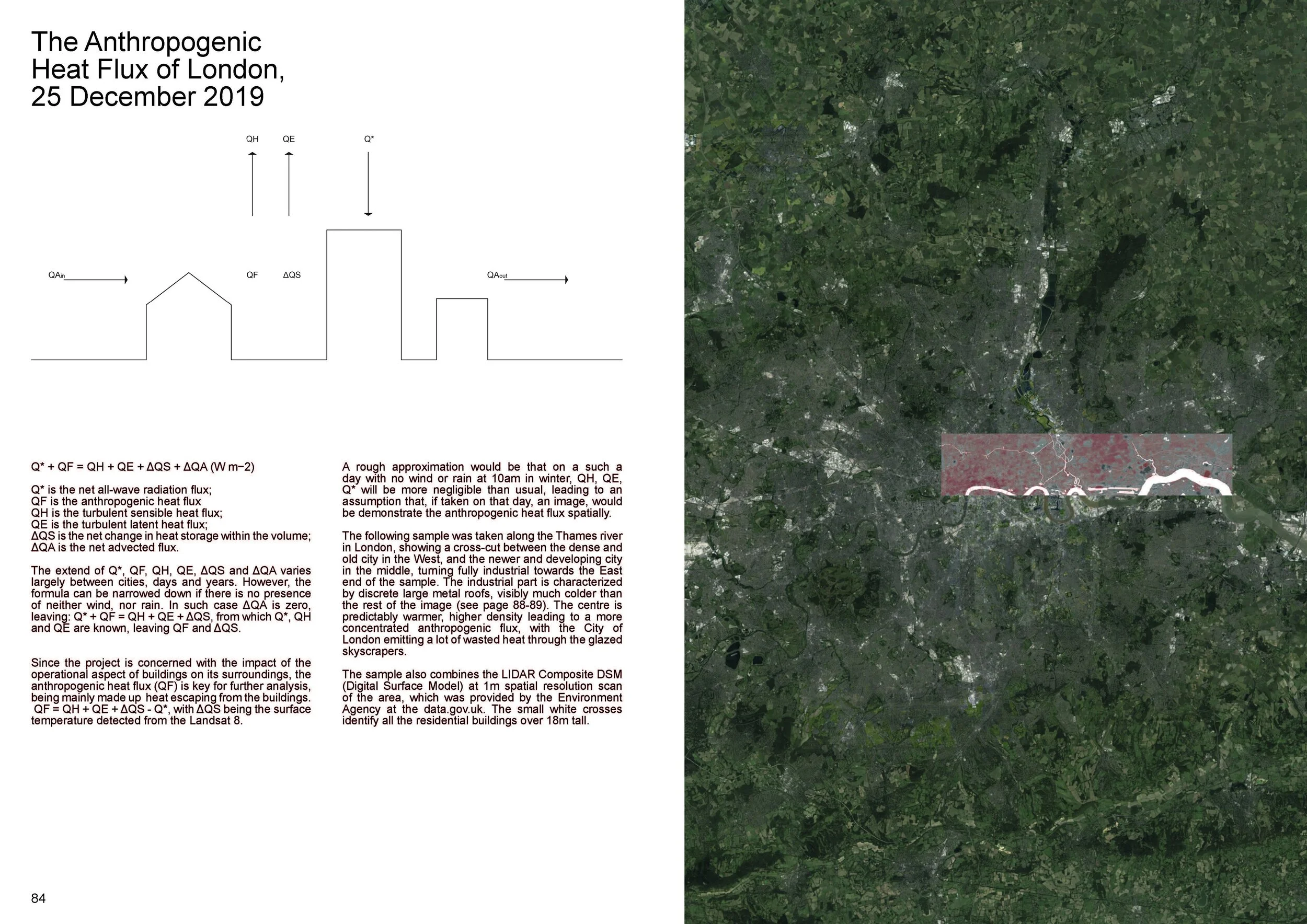
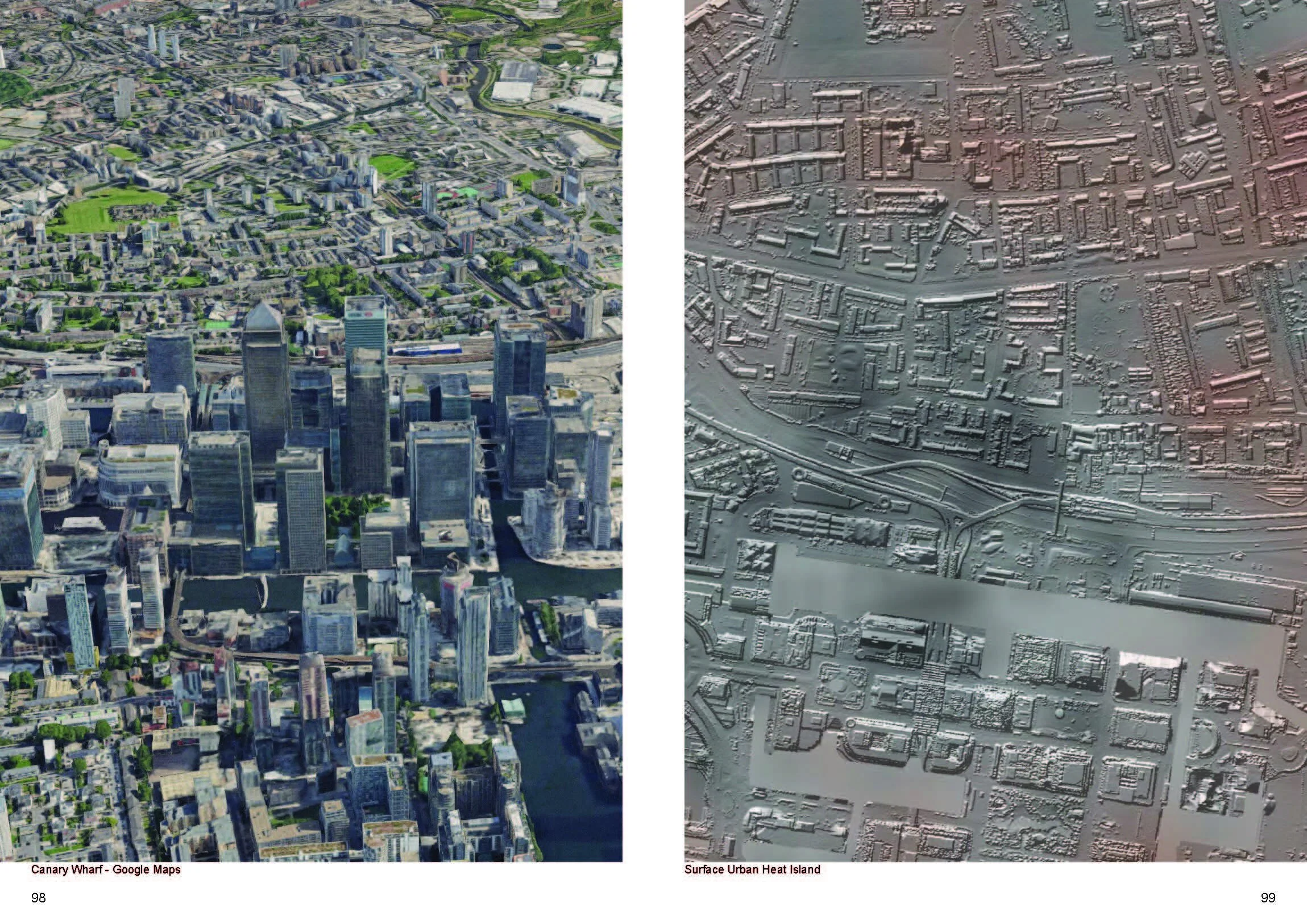
9% of all global CO2 emissions come from operations of buildings, a profoundly unnecessary expenditure. Above is an image of the data gathered by the Landsat 8 Satellite of the surface temperatures of London. I processed the data with QGIS software, which used machine learning to classify types of surfaces after I manually tagged them a few times. The spatial map of surface temperature was then generated is visualized in the video.
The data was collected on Christmas day 2019 when there was no wind and the air was cold. The image, therefore, is the direct representation of heat loss, which could be prevented with better building fabric.
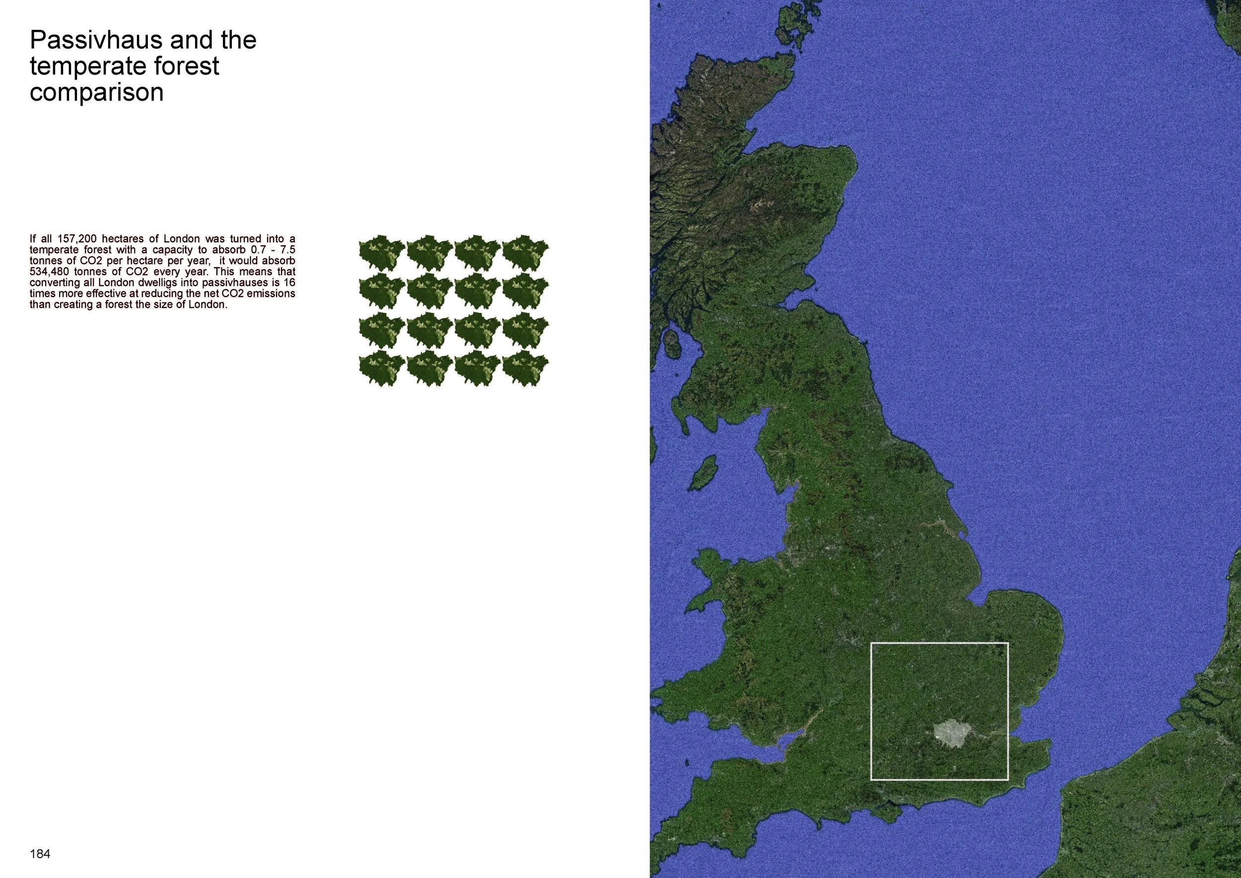
I then calculated that if all London dwellings were to be converted to Passivhaus (a German building standard for ultra-low energy usage), it would equate to planting 24 areas of London of temperate forest.
The final deliverable of the project was a 300-page book, exploring various conditions of UK policy, urban heat island and energy expenditure. Some pages from the book can be seen in the gallery below.

Heat loss (dark) through the building fabric of a Georgian home, captured with a thermal camera
London household heat loss carbon = 24 x areas of London in forest carbon capture